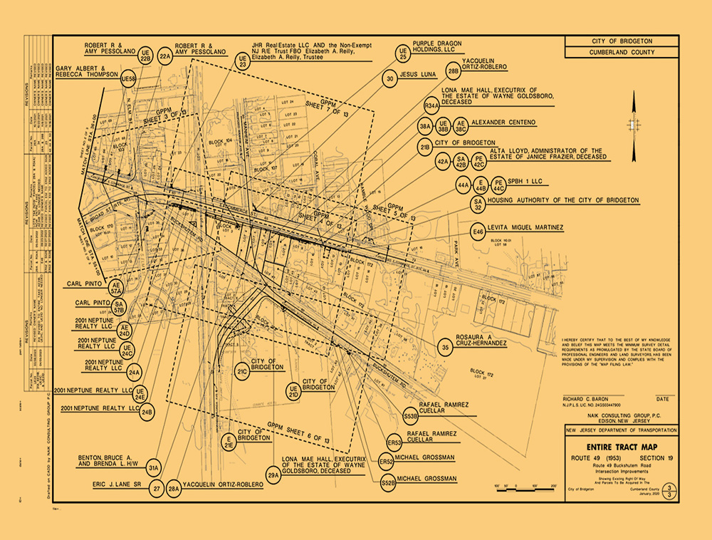
Enhancements to Route 49 and Buckshutem Road Intersection
- Client: New Jersey Department of Transportation
- Location: Bridgeton, NJ
Project Overview
The Route 49 project encompasses six intersections plagued by substandard geometric features, safety concerns, and operational inefficiencies. We have taken on the responsibility of coordinating all aspects related to surveying, right-of-way (ROW) assessment, and base mapping for the intersection enhancements, which notably included the construction of a traffic circle.
Our dedicated survey teams diligently identified the existing ROW and property monumentation, which encompassed the existing highway monumentation as well. Subsequently, a ROW mosaic was meticulously compiled, drawing from both record information analysis and the precise field location of monumentation. This meticulous process ultimately led to the establishment of the final ROW boundaries.
In our pursuit of comprehensive information, we also collected pertinent property data, ranging from buildings and parking lots (inclusive of parking space counts) to driveways and other property enhancements with the potential to influence ROW costs on properties earmarked for ROW Fee acquisitions or easements.
To facilitate the roadway improvement design, we prepared the requisite acquisition documents. In total, this endeavor impacted 29 properties, necessitating the acquisition of 35 parcels.
Gallery


